
Table of Contents
Bunker Bay sits on the northern edge of Cape Naturaliste, about 13 kilometres north of Dunsborough and roughly a three-hour drive south of Perth. The sheltered eastern end of the beach has calm, shallow water that suits families and casual swimmers; the granite-strewn western end is the snorkelling and rock-pool zone, with clearer visibility but stronger drift currents. The beach has sealed parking, toilets, showers and the Bunkers Beach House café — and a five-minute coastal walk takes you to Shelley Cove and the Cape Naturaliste lighthouse loop. Best for: family beach days, early-morning snorkelling, and a base for exploring the Cape.
Key Takeaways
- Two beaches in one bay. The eastern end is the family-swimming end; the western end is the snorkelling end. Most visitors don’t realise the difference until they’re standing on the sand.
- Early morning is the snorkelling sweet spot. Wind picks up across Geographe Bay through the day; the water is glassiest before 9am.
- Drive time: Perth → Bunker Bay is ~250 kilometres / 3 hours; Dunsborough → Bunker Bay is ~13 kilometres / 15–20 minutes via Cape Naturaliste Road.
- Loop walk: Bunker Bay connects via a five-minute coastal track to Shelley Cove, and onwards to a 3.5-kilometre loop walk from the Cape Naturaliste lighthouse car park.
- Whale season: Humpbacks and Southern Rights pass through Geographe Bay from late August to early December; the calm bay is a known rest spot.
Where is Bunker Bay?
Bunker Bay is a north-facing beach inside the Leeuwin-Naturaliste National Park, sitting on the eastern side of Cape Naturaliste in Western Australia’s South West region. The bay is roughly 250 kilometres south of Perth (a three-hour drive down Forrest Highway and the Bussell Highway) and 13 kilometres north of Dunsborough via Cape Naturaliste Road. Once you reach the cape, you turn right into Bunker Bay Road, where you can choose between the public beach car park, the Bunkers Beach House café entrance, or the resort driveway.
The beach sits inside Meelup Regional Park, which the local Wadandi people have called Country for tens of thousands of years. The eastern arc faces north into Geographe Bay; the western arc backs against the granite outcrops of the cape itself.
How far is Bunker Bay from Perth, Dunsborough and Margaret River?
- Perth → Bunker Bay: about 260 km via the Forrest Highway and Bussell Highway. Allow 3 hours without stops.
- Busselton → Bunker Bay: about 40 km / 35–45 minutes.
- Dunsborough → Bunker Bay: about 13 km / 15–20 minutes via Cape Naturaliste Road.
- Margaret River township → Bunker Bay: about 50 km / 45–55 minutes via Caves Road.
- Eagle Bay → Bunker Bay: about 5 km / 5–10 minutes by car, or a longer walk along the coast.
These times are quiet-season estimates. In peak summer the car park can fill by mid-morning and the last few kilometres along Cape Naturaliste Road slow to school-zone pace.
What’s the difference between Bunker Bay’s eastern and western ends?
The eastern end is the wide, gently sloping sand stretch most visitors picture when they think of Bunker Bay. The sand is white and soft, the water shelves slowly, and the bay’s shape shelters this section from the prevailing south-westerly. In peak summer it’s patrolled by Surf Life Saving WA volunteers and tends to attract families with younger kids.
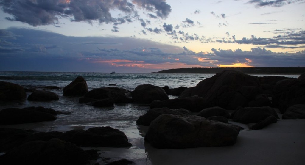
The western end is where the beach narrows against the granite outcrops below Cape Naturaliste. This is the snorkelling end. The clear, sheltered water sits above sandy patches and grassy reef edges, with granite islands a short swim offshore that experienced snorkellers loop anti-clockwise for the best fish encounters. Two practical caveats: there are no lifeguards at the western end, and the currents that keep the visibility high can drift you outward toward the open ocean if you stop paying attention.
Quick read:
| End of bay | Best for | Watch out for |
| Eastern (toward Eagle Bay) | Swimming, paddling, building sandcastles, picnic days | Crowds 11am–3pm in summer; fly season in midsummer |
| Western (toward Cape Naturaliste) | Snorkelling, rock pools, photography | Drift currents on outgoing tide; no patrols; rocks underfoot |
We’ve watched the car park fill before 10 am on a January Saturday and stay empty on a Tuesday in June. If you only have one shot at Bunker Bay, time it for the shoulder of the day.
When is the best time to visit Bunker Bay?
The honest answer is two: the question has two layers — season and time of day.
By season. December through February bring the warmest air and water (25°C to 28°C in the bay), the longest days, and the heaviest crowds. March and April keep the water warm while the school-holiday traffic thins out — locals will tell you March is the quiet superpower of the South West. June through August is winter: the water drops to about 17–18 °C, the wind shifts, the café trades become quieter, and the bay reveals a different face. Whale season runs from late August through early December, with humpbacks and southern rights frequently visible from the cape lookout above the bay.
By time of day. Across all seasons, early morning is the snorkelling window. The sea breeze across Geographe Bay strengthens through the afternoon, ruffling the surface and dropping visibility. Guests we talk to who time it for a 7am swim get the glassy water and the snorkelling visibility that everyone showing up at midday is hoping for. Sunset on Bunker Bay’s north-facing shore looks west into the cape rather than out to sea, which makes for a more sculptural light than the open Indian Ocean beaches just around the headland.
What can you actually do at Bunker Bay?
Swim. The eastern end is the swimming end — calm, shallow, patrolled in peak summer. The bay’s north-facing shape means even strong southerly weather usually leaves the water passable.
Snorkel. Head to the western end and look for the granite islands offshore. Local snorkelling guides suggest swimming an anti-clockwise loop around them; the sheltered south sides hold the fish. Bring your own gear — there’s no on-beach hire. On a clear morning, visibility runs over 10 metres.
Walk to Shelley Cove. From the café, a sealed path drops down to the rocks and continues for about five minutes to Shelley Cove — a smaller, mostly-rock pocket that’s a favourite local wedding spot for the same reason it’s a favourite snorkelling shoulder: shelter and clarity.
Walk the Cape Naturaliste loop. The Cape Naturaliste car park, a short drive on from Bunker Bay Road, is the start of a 3.5-kilometre loop along the cape headland with lookouts over the bay, Sugarloaf Rock and the open Indian Ocean. The full loop takes 60–90 minutes at a comfortable pace and is paved and largely wheelchair-accessible — unusual for a coastal walk and useful if you’re travelling with grandparents or strollers.
Fish. The bay is a quiet fishing spot most of the year, with the annual Australian salmon run usually pulling anglers in to the Cape Naturaliste beaches from mid-March through May. Check WA Fisheries rules before you cast — Meelup Regional Park has reserve-specific provisions.
Eat at Bunkers Beach House. The café at the back of the dune is the practical pivot for a long day at the beach — proper coffee, breakfast through to early dinner, and the toilet and shower block right next door. Check current opening hours before you drive: the kitchen tightens its window in winter.
Can you walk from Bunker Bay to Shelley Cove and the Cape Naturaliste lighthouse?
Bram Souffreau, CC BY-SA 2.0, via Wikimedia Commons
Yes — and the walks join up neatly enough that a fit visitor can do all three sections in a morning. The Bunkers Beach House café to Shelley Cove section is a sealed five-minute walk over the dune and along the rocks. From Shelley Cove you can either retrace, or pick up the coastal track that connects through Meelup Regional Park toward the Cape Naturaliste lighthouse car park. The full coastal connection to the lighthouse is roughly an hour each way; most visitors drive the kilometre between the two car parks and do the 3.5-kilometre lighthouse loop separately.
The lighthouse loop forms the northern tip of the Cape to Cape Track, the 130-kilometre coastal walk between Cape Naturaliste and Cape Leeuwin. You don’t need to be tackling the whole thing to enjoy the northern section.
What should you bring to Bunker Bay?
Practical packing for a Bunker Bay day, from “wading at the eastern end” to “snorkelling the western granite”:
- Reef-safe sunscreen. The water reflects hard. Reapply every two hours.
- Mask, snorkel and fins. No hire on the beach; bring your own.
- Water shoes or thin reef booties. The granite at the western end is sharp where it meets the sand.
- A windbreak or light beach tent. The sea breeze strengthens through the afternoon, especially in summer.
- A hat with a brim, and a rashie or long-sleeve UV top. The summer sun is genuine — and the cooler water of winter snorkelling is more comfortable with thermal protection.
- Fly repellent in summer. Bunker Bay’s bush backdrop gets a fly season; a small spray bottle is the difference between a great day and an itchy one.
- A picnic and a sealed rubbish bag if you’re not stopping at the café. The park is Leave No Trace — pack it in, pack it out.
- Drinking water. There’s no drinking-water fountain on the sand.
If you’re staying with us at one of the Bunker Bay or Eagle Bay homes, the rhythm most renters settle into is breakfast at the café, an early swim or snorkel, back to the property by midday, a long lunch on the verandah, and a sunset walk down the lighthouse track. The bay rewards a stay you actually unpack into.
Where should you stay to enjoy Bunker Bay properly?
The cape’s accommodation tends to fall into two camps — large resorts behind the dune, and a smaller cluster of private homes hidden in the bush around Eagle Bay and Bunker Bay. Exclusive Escapes manages the second kind. A few of the stays that put you closest to the beach:
- Eagle Bay Beach Retreat — the adjoining bay, five minutes’ drive from Bunker Bay’s car park, with the option of walking back along the coast.
- Eagle Heights — perched above Eagle Bay with sweeping views across Geographe Bay, a short drive from Bunker Bay’s snorkelling end.
- Casa Indigo — a stylish retreat tucked into the Eagle Bay bushland, blending coastal living with privacy.
- Eagle Vista — elevated positioning in the Eagle Bay pocket with bay views and easy access to the cape’s beaches.
- Waterlily Retreat — a tranquil property near Eagle Bay, well-suited to couples or small groups looking for a quieter base.
Browse the full set of Eagle Bay and Bunker Bay homes or the wider Dunsborough collection if you’re still narrowing the dates and the headcount.
Plan a longer stay? Walk through our Eagle Bay and Bunker Bay homes, or ring the office on (08) 9755 3644 if you want help shortlisting properties for your dates.
Frequently Asked Questions
Can I bring my dog to Bunker Bay?
Bunker Bay sits inside Meelup Regional Park, and the park’s official rule is that dogs are not permitted in the reserve — that includes the beach, the trails and the bush behind the dune. The local designated dog-exercise beach is on a marked section of Eagle Bay, a few kilometres east. Check the City of Busselton’s dog exercise areas page for the current map before you travel — the park-management page at Meelup Park also notes that 1080 baiting is carried out within the park year-round, which is a serious risk to dogs.
Is there parking at Bunker Bay, and is it free?
Yes. The sealed public car park sits between the resort and the café, with toilets, outdoor showers and a wheelchair-accessible bay. Parking is free. In December and January it can fill by 10am on weekends; arrive before 9am or after 3pm for a clean run.
Is Bunker Bay good for surfing?
Bunker Bay itself is too sheltered for consistent surf — that’s why it’s so good for swimming and snorkelling. Surfers in the area head for Yallingup, Smiths Beach or Sugarloaf Rock just around the cape, all within 15 minutes’ drive.
Can you see whales at Bunker Bay?
The sheltered bay is a known rest spot for humpbacks and southern rights during the late-August to early-December migration. You’ll get better viewing from the Cape Naturaliste lighthouse lookout and the headland walks than from the beach itself. Pygmy blue whales feed in nearby Perth Canyon and occasionally pass through Geographe Bay.
Is Bunker Bay safe for kids to swim?
The eastern end of the bay is shallow, sheltered and patrolled by Surf Life Saving WA volunteers in peak summer. The western end has stronger drift currents that build through the day, so it’s not the swimming end for children. Pick your end, and check for surf-club signage on the beach before letting kids into the water unsupervised.
What time does Bunkers Beach House café open?
Hours change with the season — typically breakfast and lunch year-round, with extended evening service in summer and a tighter winter window. Confirm with the café before you drive out; the Pullman Bunker Bay restaurant is the alternative on the same headland.
About this guide
This guide was put together by the Exclusive Escapes editorial team. Exclusive Escapes manages private holiday homes around Bunker Bay, Eagle Bay and Dunsborough. We drew on the Department of Biodiversity, Conservation and Attractions (Explore Parks WA) for park status and reserve rules; Tourism Western Australia for visitor information; the Meelup Regional Park visitor pages for the swimming and snorkelling zone notes; and the Cape to Cape Track DBCA page for the walking-track detail. The eastern-versus-western-end framing reflects our team’s repeated visits and conversations with guests staying in the Cape Naturaliste homes we manage.